World Geography: Some Glimpses
1. Introduction to World Geography
Geography helps us understand the Earth, its physical features, its natural environment, and the relationship between human beings and nature.
– The Earth is often called the Blue Planet because oceans cover most of its surface.
– The Earth has a wide variety of physical features, including mountains, plateaus, plains, deserts, grasslands, rivers, and oceans.
– Human life is closely connected to these geographical features. They influence climate, agriculture, settlement, transportation, trade, and the availability of water.
– Natural features are interconnected. For example, the Southern Indian Ocean influences the monsoon in the Gangetic Plains.
– Indigenous communities have traditionally revered the Earth as a mother. In India, the Earth is personified as a living deity known as Bhudevi or Vasudha.
Why do we study world geography?
1. To understand the physical features of different continents.
2. To learn how landforms and water bodies influence human life.
3. To understand the relationship between the environment and climate.
4. To recognise the importance of natural resources and ecosystems.
5. To understand how human activities can cause environmental problems.
6. To learn why natural resources must be managed wisely for sustainable development.
2. Maps and the Complexity of Mapping the Earth
Meaning of a cartographer
A cartographer is a person who draws or produces maps.
Meaning of an oblate spheroid
The Earth is an oblate spheroid, meaning it is nearly spherical but bulges slightly at the Equator and is slightly flattened at the poles because of its rotation.
Why do maps have distortion?
The Earth is three-dimensional and curved, whereas a map is usually drawn on a flat surface. It is impossible to represent the entire curved surface of the Earth on a flat surface without some distortion.
The chapter explains this with the example of an orange. If an orange peel is removed and laid flat, it cannot be spread out perfectly without tearing or changing its shape. In the same way, representing the Earth on a flat surface creates distortions.
The process of representing the Earth’s curved surface on a flat surface is called a map projection.
Important map projections
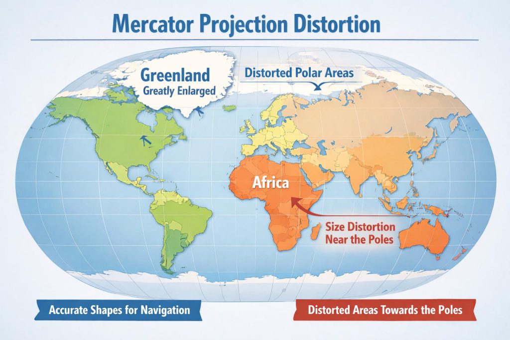
A. Mercator Projection
– Preserves the shapes and directions of places.
– Useful for navigation.
– Greatly distorts the sizes of areas near the poles.
– Greenland appears much larger than it actually is compared with Africa and India.
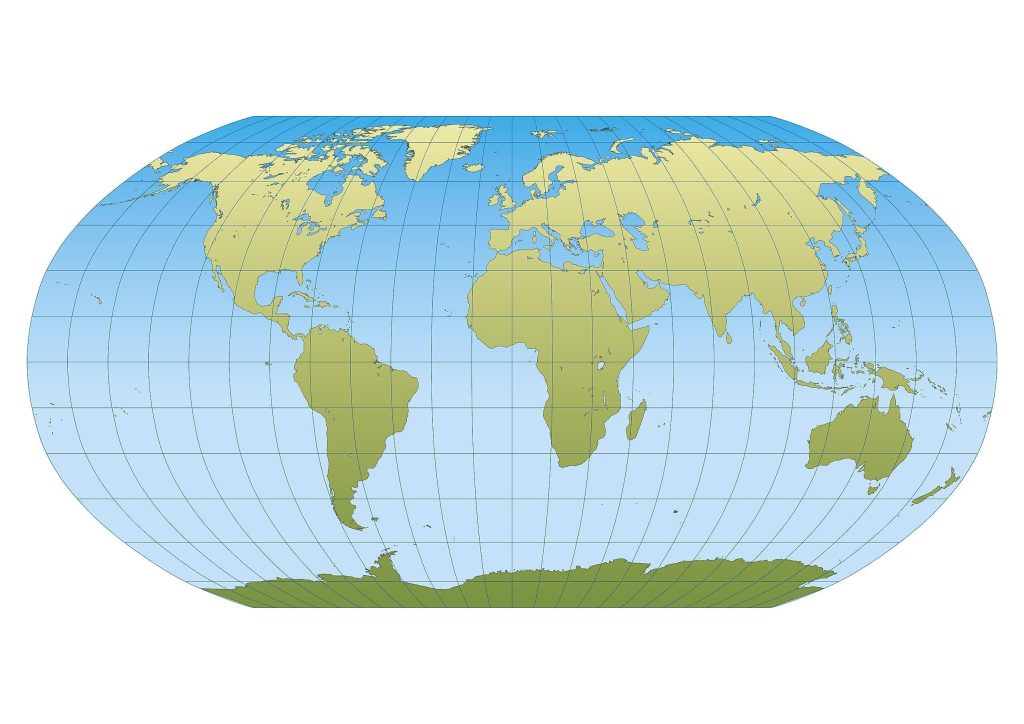
B. Robinson Projection
– Balances distortions in size and shape.
– Provides a visually pleasing and more realistic overall representation of the world.
– It is a compromise rather than a perfectly accurate representation.
Important point: Every map projection involves some compromise. To understand the world fairly, we should consider different projections rather than depending on a single map.
Maps also help us understand the approximate size, shape, location, and distance of geographical features. For greater precision, professionals use latitude and longitude coordinates.
Colours used on physical maps
Physical maps use colours to represent different natural features.
| Colour | What it represents |
|---|---|
| Blue | Water bodies, such as oceans, seas, lakes, and rivers |
| Green | Plains |
| Yellow/Brown | Plateaus |
| Dark brown | High mountains |
| Light yellow | Deserts |
| White | Ice and glaciers |
3. The Blue Planet: Oceans
Meaning and importance of oceans
An ocean is a vast body of saltwater. Oceans cover approximately 71% of the Earth’s surface and contain about 97% of the Earth’s water.
The Earth appears blue when viewed from space because such a large part of its surface is covered by oceans.
Importance of oceans
– Support life: Oceans provide habitats for organisms ranging from microscopic plankton to enormous blue whales.
– Regulate climate: They absorb heat and release it slowly, helping regulate the Earth’s climate.
– Help produce rainfall: Oceans add moisture to the air, contributing to cloud formation and rainfall.
– Produce oxygen: Tiny marine organisms, including plankton, produce almost half of the oxygen we breathe.
– Support trade and transportation: Oceans and their waterways serve as important routes for international trade.
– Provide habitats: Ocean environments contain a wide variety of marine plants and animals.
The ocean floor is not flat. Like land, it contains mountains, valleys, plains, and deep trenches.
The five oceans
The five oceans are the Pacific, Atlantic, Indian, Southern, and Arctic Oceans.
| Ocean | Important Features |
|---|---|
| Pacific Ocean | The largest and deepest ocean; supports marine life, including whales and tuna. |
| Atlantic Ocean | One of the busiest waterways for trade and transportation; also an important fishing ground. |
| Indian Ocean | Its warm waters support rich biodiversity, and it has historically been important for international trade. |
| Southern Ocean | Encircles Antarctica and provides habitat for penguins and seals. |
| Arctic Ocean | The smallest and shallowest ocean; covered with sea ice and home to polar bears and walruses. |
Ocean currents
Ocean currents are large streams of moving water within the oceans. They are of two main types:
1. Warm currents: Carry warm water from the Equator towards the poles.
2. Cold currents: Carry cold water from polar regions towards the Equator.
Ocean currents influence the climate of coastal areas.
Example: The Gulf Stream
- – The Gulf Stream carries warm water northwards from near the Equator through the Atlantic Ocean towards Western Europe.
- – This warm water helps make places such as the United Kingdom warmer than other places at the same latitude.
Ocean trenches
Ocean trenches are very deep, V-shaped areas of the ocean floor.
The Mariana Trench is the deepest ocean trench described in the chapter.
– It is more than 2,000 metres deeper than the height of Mount Everest.
– Its deepest section is called Challenger Deep.
– Challenger Deep reaches more than 11,000 metres below sea level.
– The environment has near-freezing temperatures, extremely high pressure, and complete darkness.
Despite these harsh conditions, unique life forms survive in the Mariana Trench. Since sunlight is absent, plants cannot use photosynthesis to make food. Some organisms obtain energy from chemicals in the water to produce food.
This demonstrates that life can survive in environments that are very different from those found on the Earth’s surface.
4. The Great Barrier Reef
Meaning of a reef
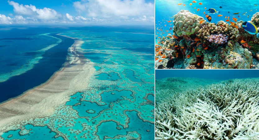
A reef is a ridge found at or near the surface of the ocean. It may form naturally or artificially. Natural reefs may consist of rock or be built by tiny marine animals called corals.
Why are coral reefs called the rainforests of the sea?
Coral reefs are called the rainforests of the sea because they are among the most diverse ecosystems on Earth. They provide food and shelter for approximately one-quarter of all ocean species, including fish, crabs, turtles, and sponges.
The Great Barrier Reef: Location and features
– It lies off the northeastern coast of Australia.
– It stretches for more than 2,000 kilometres.
– It covers approximately 350,000 square kilometres.
– It contains hundreds of coral species and thousands of species of fish and other marine animals.
– It is recognised as a UNESCO World Heritage Site.
– It is one of the most remarkable geographical features of the planet.
Threats to coral reefs
The Great Barrier Reef faces serious threats from human activities, including:
1. Overfishing: Excessive fishing can disturb marine ecosystems.
2. Pollution: Pollutants can damage marine habitats.
3. Climate change: Changes in ocean conditions affect coral survival.
4. Coral bleaching: Changes in the chemical composition of ocean water, largely caused by human actions, can lead to coral bleaching and death.
When corals die, marine animals lose their habitats. Therefore, conserving coral reefs is essential for protecting marine biodiversity.
5. Smaller Water Bodies and Waterways
Different sea formations and waterways are classified according to their shape, location, and purpose.
| Type | Definition | Example |
|---|---|---|
| Sea | A large, partly enclosed saltwater area connected to an ocean | Arabian Sea |
| Gulf | A large inlet of the sea that extends deeply into the land | Persian Gulf |
| Bay | A smaller, broad inlet of the sea | Bay of Bengal |
| Strait | A narrow channel joining two seas or oceans | Strait of Malacca |
| Canal | A human-made channel connecting water bodies | Suez Canal |
Importance of seas, bays, gulfs, straits, and canals
– They provide important routes for trade and transportation.
– Gulfs and seas have historically connected trading regions.
– Bays can provide sheltered locations for ports and dockyards, protecting them from strong winds in the open ocean.
– Straits provide narrow passages between water bodies.
– Canals create or shorten navigation routes between different regions.
The Bay of Bengal: It is the world’s largest bay. It is important for trade, influences climate, and supports a variety of plant and animal life.
The Suez Canal
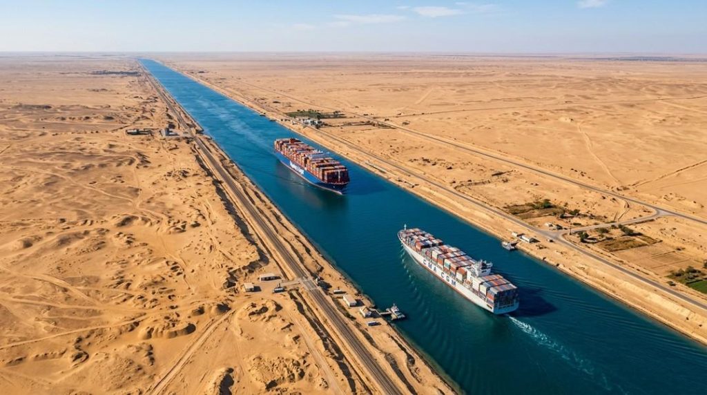
The Suez Canal is a human-made waterway that opened in 1869.
– It connects the Red Sea with the Mediterranean Sea.
– It creates a water route between the Indian Ocean and Europe.
– It provides the shortest maritime route from India to Europe, as illustrated in the chapter.
The Suez Canal demonstrates how human-made waterways can improve connections between regions and facilitate international trade.
6. The Continents: Variety on Land
The Earth’s land surface contains a wide variety of landforms. These include mountains, plateaus, plains, deserts, and grasslands. Each landform has distinctive characteristics and influences the environment and human life in different ways.
Major landforms
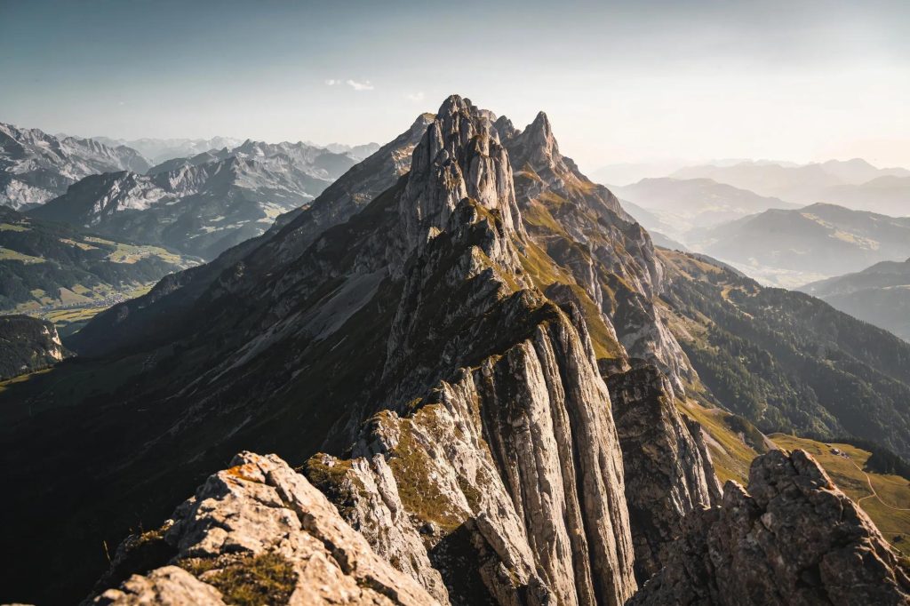
Mountains
Mountains are landforms that rise much higher than the surrounding landscape. They generally have a broad base, steep slopes, and a narrow summit. They influence climate, provide freshwater, support biodiversity, and may form natural boundaries between countries.
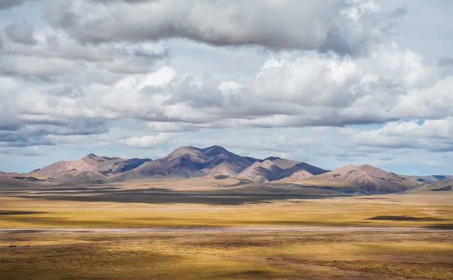
Plateaus
A plateau is an elevated landform with a more or less flat surface. Some of its sides have steep slopes. Plateaus can contain valuable natural resources and influence regional geography.
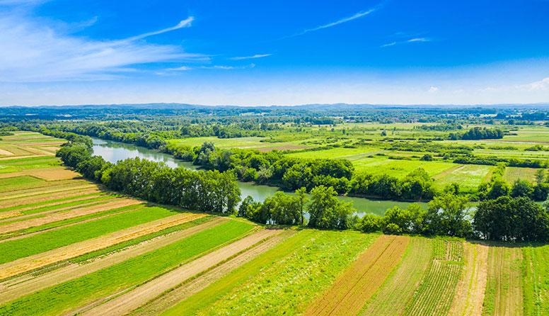
Plains
Plains are extensive areas of flat or gently undulating land without large hills or deep valleys. Their fertile soils often support agriculture, trade, transportation, and dense populations.
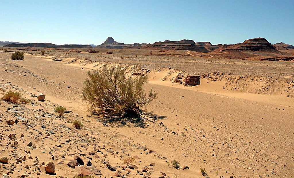
Deserts
Deserts are large, dry areas that receive very little precipitation. Their plants and animals have distinctive adaptations. Deserts can be hot, such as the Sahara and Thar, or cold, such as the Gobi.
Other important geographical terms
– Continent: A large, continuous expanse of land.
– Valley: A low area, often carved by rivers, that can provide fertile soil, water, and transport routes.
– Grassland: An area dominated by grasses, often supporting grazing animals and wildlife.
– Erosion: A natural process that shapes the Earth’s surface by wearing away and moving material.
– Deposition: The laying down of material, such as sediments, that can contribute to the formation of landforms.
– Tectonic forces: Geological forces associated with movements of the Earth’s crust and tectonic plates.
The seven continents
The seven-continent model includes:
1. Asia
2. Africa
3. Antarctica
4. Australia
5. Europe
6. North America
7. South America
The following sections examine important geographical features of these continents and explain their relationship with nature and human activities.
7. Asia
Asia contains a wide variety of physical features, including high mountain ranges, elevated plateaus, extensive deserts, and grasslands. The chapter highlights the Tibetan Plateau, the Gobi Desert, the Eurasian Steppes, and the Ural Mountains.
A. The Tibetan Plateau — Roof of the World
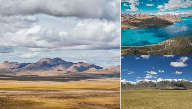
The Tibetan Plateau is the highest and largest plateau on Earth.
Location and formation
- It lies north of the Himalayan Range.
- It was formed through collisions between the Indo-Australian and Eurasian tectonic plates.
- These plate collisions also led to the formation of the Himalayan mountain range.
Physical features
- It extends approximately 2,500 kilometres from east to west.
- It extends approximately 1,000 kilometres from north to south.
- Its average elevation is more than 4,500 metres above sea level.
Importance of the Tibetan Plateau
1. Influence on climate: It plays an important role in influencing the climate of Asia.
2. Source of major rivers: It is the source of major rivers, including the Indus, Brahmaputra, and Yangtze.
3. Freshwater reserves: The plateau and its mountains are known as the Third Pole because the region contains the largest reserves of freshwater outside the polar regions.
4. Environmental changes: Climate change has caused snowmelt, leading to the expansion of existing lakes and the formation of new ones.
The Tibetan Plateau is important because of its great height, geological origin, influence on climate, and role in supplying freshwater.
B. The Gobi Desert — Land of the Eternal Blue Sky
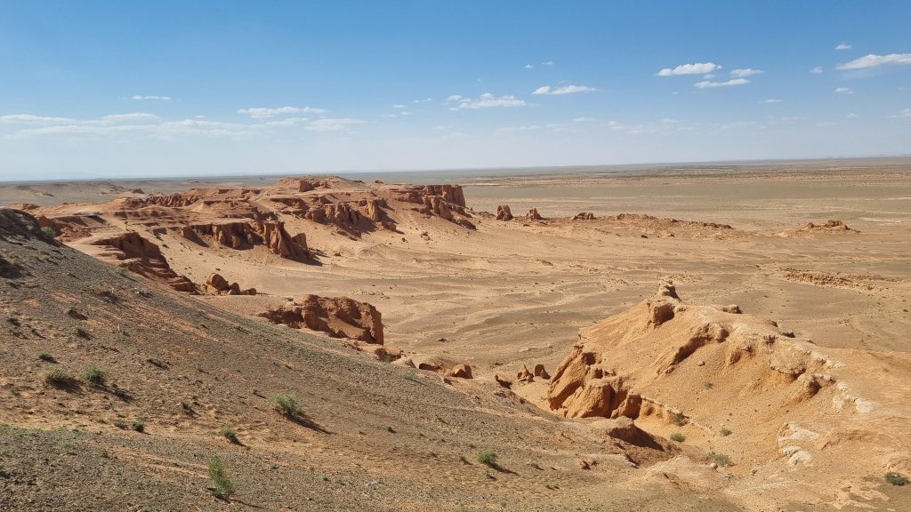
A desert is a large, extremely dry area receiving very little precipitation.
General characteristics of deserts
- Deserts receive less than 25 centimetres of precipitation per year, according to the chapter’s definition.
- They occur on every continent.
- They cover approximately one-fifth of the Earth’s land area.
- Around one billion people, or approximately one-eighth of the world’s population as stated in the chapter, live in deserts.
Location and climate of the Gobi Desert
- The Gobi Desert is located in Mongolia, with part of it extending into northern China.
- Mongolia is called the Land of the Eternal Blue Sky because it receives about eight to nine months of sunny weather.
- Despite the sunny conditions, winter temperatures can fall to −30°C.
- The climate is harsh, and vegetation is sparse.
Human and animal life
- Vegetation is limited because of the dry conditions.
- Herds migrate seasonally to reach pastures.
- Underground water supplies support vegetation and grazing in certain areas.
- The environment requires people and animals to adapt to difficult climatic conditions.
Harnessing natural energy: The chapter illustrates the use of solar panels and windmills in the Gobi Desert, showing how natural conditions can be used to obtain energy.
C. The Eurasian Steppes
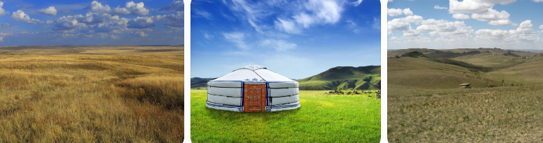
A steppe is a large area of flat, unforested grassland with a temperate climate, hot summers, cold winters, and moderate, often seasonal rainfall.
Location and extent
- The Eurasian Steppes extend for more than 8,000 kilometres from west to east.
- They form an extensive grassland region.
Environmental importance
- The steppes act as a global carbon sink.
- They absorb carbon from the air and store it underground.
- This helps reduce greenhouse effects over time.
- Their grasslands and nearby water bodies provide resting places for migratory birds, such as the Siberian crane.
Wildlife and human life
- The steppe tortoise lives in burrows that can be almost two metres deep.
- It hibernates for two to five months, depending on weather conditions.
- The traditional hut of nomadic people living in the steppes is called a yurt.
- The grasslands support grazing and seasonal movement of herds.
The steppes are significant for carbon storage, grassland ecosystems, migratory birds, and traditional ways of life.
D. The Ural Mountains
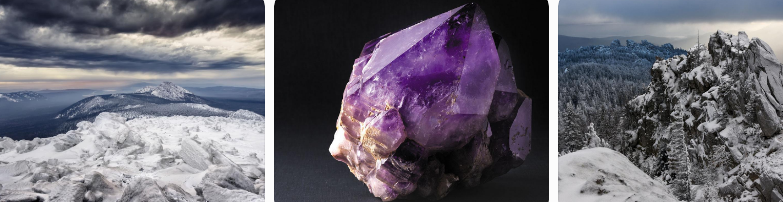
Mountains are formed through processes that include tectonic forces, volcanic activity, and erosion.
Location and physical features
- The Ural Mountains stretch approximately 2,500 kilometres.
- They extend from the Arctic Ocean in the north to the border of Kazakhstan in the south.
- They form a natural boundary between Europe and Asia.
- Their physical features include rugged slopes, caves, valleys, and forests.
Importance of mountains
Mountains perform several important functions:
- They influence regional climates.
- They support biodiversity.
- They often form natural boundaries between countries.
- They provide freshwater through melting snow and glaciers.
For these reasons, mountains are sometimes called water towers.
Mineral resources
The Ural Mountains contain several valuable resources, including:
- Iron ore
- Copper
- Zinc
- Platinum
- Gold
- Coal
- Oil
- Natural gas
Vegetation and wildlife
- Coniferous taiga forests dominate the western and eastern parts of the range.
- Deciduous forests are found in the south.
- Animals include brown bears, wolves, lynx, elk, reindeer, and sable.
- The region also contains northern tundra, swamps, and fertile southern farmland.
The Urals are important for their ecological diversity, natural beauty, mineral wealth, and economic value.
E. Taiga, tundra, and permafrost
The chapter also introduces two important cold-region environments.
Taiga: A forested region dominated by coniferous trees. Taiga forests occur in parts of the Ural region and Siberia.
Tundra: A cold, treeless plain where the soil remains frozen for much of the time.
Permafrost: Permanently or persistently frozen ground that acts like a giant freezer, trapping greenhouse gases such as carbon dioxide and methane.
Effect of global warming on permafrost
- Global warming raises temperatures.
- Frozen ground begins to melt.
- Stored greenhouse gases can be released.
- These gases can contribute to further climate change.
This illustrates how changes in cold-region environments can affect the global climate.
8. Europe
Europe contains extensive plains, river valleys, and mountain ranges. The chapter focuses on the European Plain and the Alps.
A. The European Plain
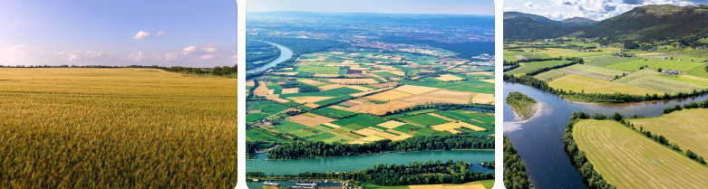
The European Plain, also known as the Great European Plain, is one of the largest flatland regions in the world. It extends across parts of several European countries.
Physical characteristics
- It consists mainly of low-lying terrain.
- It contains gentle rolling hills and wide river valleys.
- Its landforms are suitable for agriculture and transportation.
Formation and importance of plains
Plains are often formed by the deposition of sediments. Their fertile soils support agriculture, while river valleys provide water and transportation routes.
Agriculture
The European Plain is one of the world’s most productive agricultural regions because of its fertile soils and favourable climate.
Important crops include:
- Wheat
- Barley
- Rye
- Potatoes
Rivers and transportation
The rivers of the European Plain have played an important role in trade and transportation. They connect settlements and support economic activities.
Natural resources
The region contains deposits of:
- Coal
- Oil
- Natural gas
These resources have contributed to economic growth.
Cities and population
The relatively flat land and favourable climate have supported the growth of major cities, including Moscow, Berlin, Paris, Amsterdam, and Warsaw.
Historical and economic importance
- The European Plain has been the site of major battles because different rulers sought to control the region.
- It remains important to Europe’s economy.
- Agriculture and transportation are two of its major economic activities.
B. The Alps
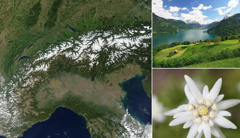
The Alps are a crescent-shaped mountain range in south-central Europe. They extend for approximately 1,200 kilometres.
Main features
- They form a natural barrier in south-central Europe.
- They are known for their scenic landscapes.
- They attract visitors for skiing and hiking.
- Mont Blanc is one of their famous peaks.
Vegetation
Vegetation changes with altitude:
- Oak and beech forests grow at lower altitudes.
- Spruce and pine trees grow at higher elevations.
- Alpine flowers, including edelweiss, grow in the high mountains.
Edelweiss is the national flower of Austria and belongs to the sunflower family.
Wildlife
The Alps provide habitats for animals such as:
- Ibex
- Chamois
- Marmots
- Golden eagles
- Lynxes
- Wolves
- Brown bears
Water resources and economic importance
- The Alps provide water to major European rivers, including the Rhine and tributaries of the Danube.
- These rivers supply drinking water and irrigation and support hydroelectric power generation in lowland Europe.
- The region contains minerals such as iron, copper, lead, rock salt, graphite, gypsum, and magnesite.
- Forests and fertile land add to the region’s natural and economic importance.
The Alps demonstrate how mountains support biodiversity, water supply, tourism, and economic activities.
9. Africa
Africa has varied landforms, including extensive deserts, grasslands, and major river systems. The chapter highlights the Sahara Desert, the African Savannah, and the Nile River.
A. The Sahara Desert
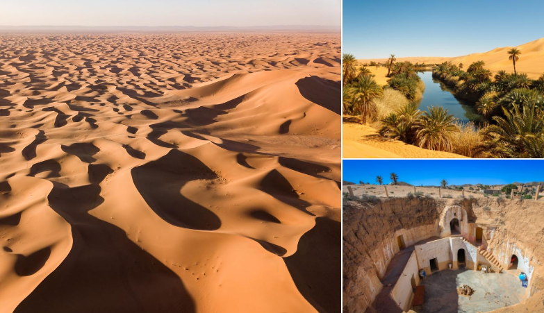
The Sahara Desert is the largest hot desert in the world.
Climate and vegetation
- Temperatures commonly range from 30°C to 46°C across the desert, as described in the chapter.
- Rainfall is below 25 centimetres.
- Vegetation is scarce in many areas.
- Some parts experience extreme heat, with temperatures sometimes exceeding 50°C.
Oases
An oasis is an area in a desert where water and vegetation are available. Date palm trees are found in oases, and dates provide carbohydrates, vitamins, and minerals.
Adaptations to desert conditions
Plants, animals, and human communities have developed ways to cope with extreme heat and limited water.
Examples from the chapter include:
- Cacti: Store water in their leaves, as described in the chapter.
- Fennec fox: Its large ears help release heat and detect the sounds of prey underground.
- Nomadic communities: Traditional clothing and headgear help keep the body cool.
- Underground dwellings: These houses remain cooler in summer and warmer in winter.
Human life and trade
- Nomadic tribes have lived in the Sahara by herding sheep, goats, and camels.
- Livestock herding and trade have been important sources of livelihood.
- Ancient trade routes passed through the desert.
- These routes carried gold, salt, and ideas to the Mediterranean world.
The Sahara shows that deserts are not empty regions; they support human communities, wildlife, and economic activities adapted to dry conditions.
B. The African Savannah
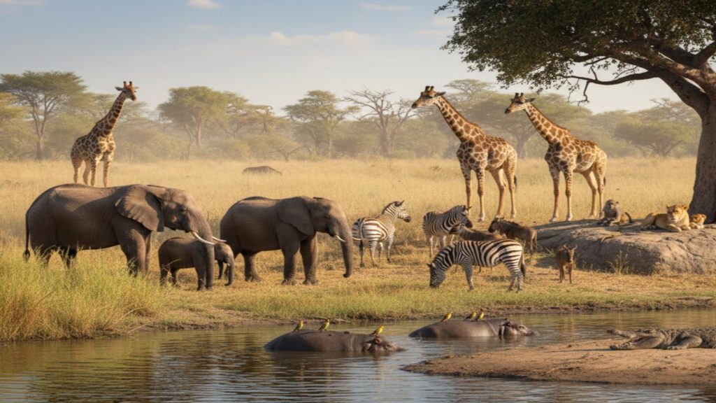
A savannah is a tropical grassland ecosystem with extensive open spaces, scattered trees, and seasonal rainfall.
Location and climate
– Savannahs are found mainly between tropical rainforests and deserts.
– Africa contains one of the best-known savannah regions.
– The climate has distinct wet and dry seasons.
– Seasonal rainfall influences plant growth and animal migration.
Vegetation and wildlife
The savannah supports rich biodiversity. Its grasses and waterholes provide food and water for animals such as:
– Elephants
– Lions
– Zebras
– Giraffes
Environmental threats
Human activities are threatening the balance of savannah ecosystems.
The main threats described in the chapter are:
1. Farming that alters natural grasslands.
2. Deforestation.
3. Climate change.
The savannah is important because it supports wildlife, grassland vegetation, and ecological relationships between plants and animals.
C. The Nile River
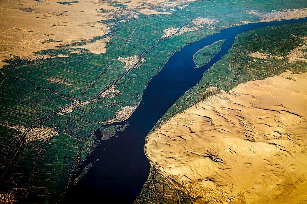
The Nile River is described in the chapter as the longest river in the world, measuring approximately 6,650 kilometres.
Historical importance
– The Nile and its basin were the cradle of ancient Egyptian civilisation.
– The river has supported human settlement for thousands of years.
– Its water transformed dry areas into fertile agricultural lands.
Agricultural importance
The river provides water for irrigation and supports the cultivation of:
– Wheat
– Barley
– Flax
– Fruits
– Vegetables
Other uses
The Nile provides:
– Drinking water
– Fish and fishing opportunities
– Hydroelectric power
– Transportation routes
The Nile demonstrates the importance of rivers in supporting agriculture, civilisation, trade, and settlement, especially in dry regions.
10. South America
South America contains high mountain ranges, extensive rainforests, major rivers, and extremely dry desert regions. The chapter focuses on the Andes Mountains, the Amazon Rainforest, the Amazon River, and the Atacama Desert.
A. The Andes Mountains
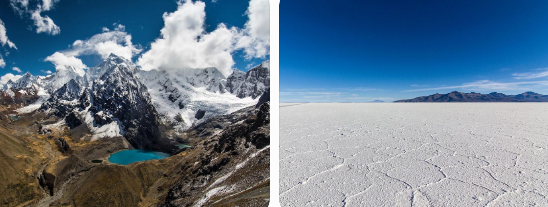
The Andes Mountains are the largest mountain range in South America and lie along its western side.
Important geographical features
– Mount Aconcagua is the highest peak in the Western Hemisphere.
– Bolivia’s Uyuni Salt Flats are the largest salt flat on Earth.
– The Andes are an important source of freshwater for millions of people.
Importance of the Andes
Water resources: The mountains supply freshwater and feed major rivers, including the Amazon.
Biodiversity: The region supports thousands of species of mammals, birds, amphibians, reptiles, and fish. Many species are unique to the region.
Conservation importance: According to the chapter, only about one-quarter of the original flora and fauna remains. This makes the Andes a critical conservation hotspot.
A conservation hotspot is an area where efforts are made to protect native plant and animal life that has been lost or threatened, generally due to human activities.
Mineral resources
The Andes contain extensive reserves of:
– Copper
– Zinc
– Silver
– Lithium
Thus, the Andes are significant for freshwater, biodiversity, mineral resources, and conservation.
B. The Amazon River and Amazon Rainforest
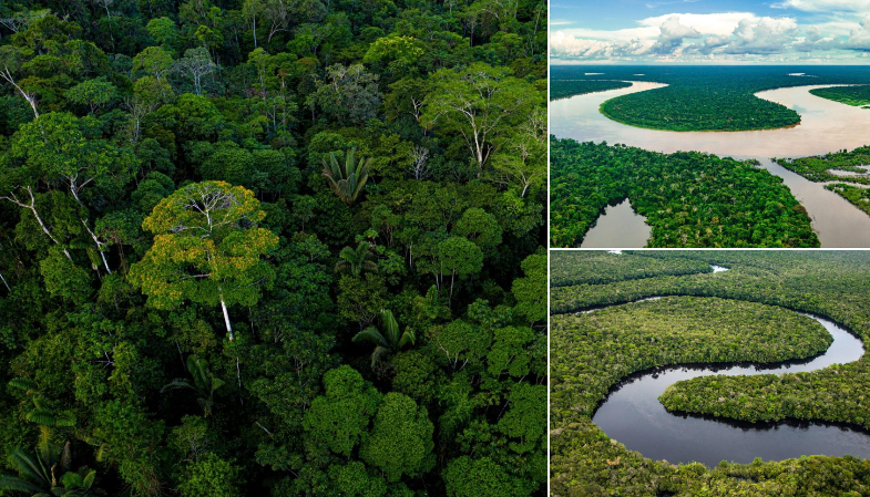
The Amazon River
– The Amazon is the longest river in South America.
– It begins in the Andes Mountains in Peru.
– It flows eastwards towards the Atlantic Ocean.
– Its basin and tributaries support the Amazon Rainforest.
The Amazon River is also described in the chapter as the world’s largest river by volume.
The Amazon Rainforest
A rainforest is an area of tall, mostly evergreen trees that receives a high amount of rainfall.
The Amazon Rainforest is an important natural ecosystem because it supports a great variety of plant and animal life.
Indigenous communities
– Almost 400 indigenous communities reside in the forest.
– These communities play an important role in conserving the forest.
– Their lives and cultures are connected with the surrounding environment.
Connection between the Sahara and the Amazon
Dust travels from the Sahara Desert to the Amazon Rainforest. This dust carries phosphorus, which is needed by plants in the rainforest.
This example shows that geographical regions can be connected even when they are separated by vast distances.
Why is the Amazon Rainforest called the Lungs of the Earth?
The chapter raises this as a question for discussion. The name highlights the rainforest’s global environmental importance and its relationship with the Earth’s atmosphere.
Environmental threats
The Amazon Rainforest faces two major threats:
– Deforestation
– Climate change
Deforestation reduces forest cover and threatens the habitats of plants and animals. Protecting the rainforest is important for conserving biodiversity and maintaining environmental balance.
C. The Atacama Desert
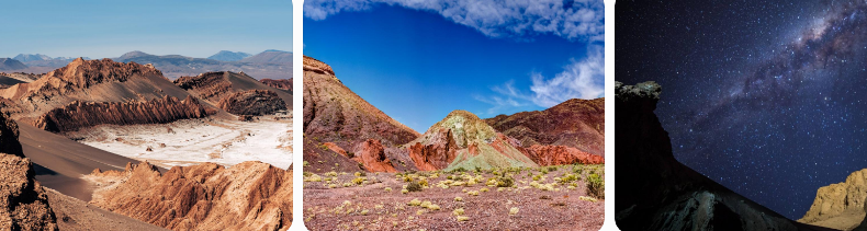
The Atacama Desert is located in Chile and is one of the driest places on Earth.
Main features
– It extends for approximately 1,000 kilometres.
– Daytime temperatures can reach around 40°C.
– Night-time temperatures can fall to around 5°C.
– Its landscape includes rocky formations and areas coloured by different minerals in the soil.
Scientific importance
– The desert is famous for stargazing because it offers some of the clearest night skies.
– Its rocky, Mars-like landscape has been used by NASA to test rovers.
Environmental problem: Discarded clothing
The Atacama Desert has become one of the world’s rapidly growing dumping grounds for discarded clothing.
The chapter links this problem to fast fashion.
Fast fashion means producing trendy clothing quickly and at low cost, often in countries where labour is paid low wages. Such clothing may be discarded quickly when fashion trends change.
The dumping of discarded clothes creates an environmental and social problem. It demonstrates how consumption and waste generated by human activities can damage even remote environments.
11. North America
North America contains plateaus, mountain ranges, canyons, and freshwater lakes. The chapter examines the Colorado Plateau, Rocky Mountains, Appalachian Mountains, and Great Lakes.
A. The Colorado Plateau
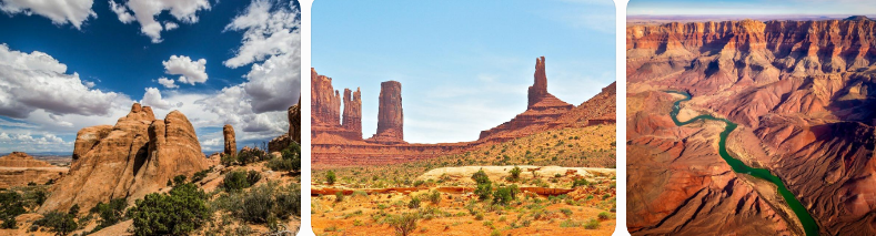
The Colorado Plateau is a large highland region in the southwestern United States.
Location and size
– It extends across several states.
– It covers more than 330,000 square kilometres.
– It is known for remarkable landscapes, including the Grand Canyon.
Formation
– The plateau consists mainly of layers of sedimentary rock.
– Tectonic forces gradually uplifted these rock layers.
– Erosion shaped the landscape over millions of years.
– These processes produced dramatic red rock formations and deep canyons.
Natural resources
The region contains:
– Coal
– Oil
– Natural gas
– Uranium
– Copper
– Other minerals
Economic and environmental importance
– Its geological formations attract tourists.
– It supports natural resource use.
– Its plant life includes coniferous and deciduous trees.
– The Grand Canyon has received approximately five million visitors annually over the several years mentioned in the chapter.
The Colorado Plateau demonstrates how tectonic forces and erosion create distinctive landscapes that can become important for tourism and natural resources.
B. The Rocky Mountains
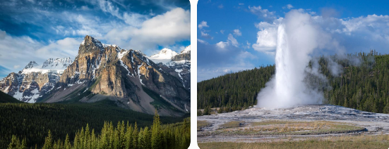
The Rocky Mountains, also called the Rockies, form an extensive mountain range stretching more than 4,800 kilometres.
Natural resources
The Rockies contain resources such as:
– Copper
– Gold
– Silver
Economic activities
The region contributes to economic activity through:
– Mining
– Hydropower generation
– Tourism
– Agriculture
Indigenous communities
– Large indigenous communities, referred to in the chapter as Native Americans, lived in the region until about 300 years ago.
– These communities depended on rivers, forests, and wildlife for their sustenance.
– They regarded the mountains as sacred.
– Today, many live on reservations established for them.
Yellowstone National Park and ecosystem restoration
Yellowstone National Park, located in the Rockies, is an example of ecosystem restoration.
– The park experienced ecological imbalance because of overgrazing by elk, a type of deer.
– Wolves were introduced in 1995.
– The wolves hunted elk, reducing their population.
– This allowed vegetation to return and helped restore ecological balance.
The park also contains geysers.
A geyser is a jet of boiling water and steam. The chapter explains that the geyser called Old Faithful erupts because of volcanic activity deep beneath the Earth’s surface.
C. The Appalachian Mountains
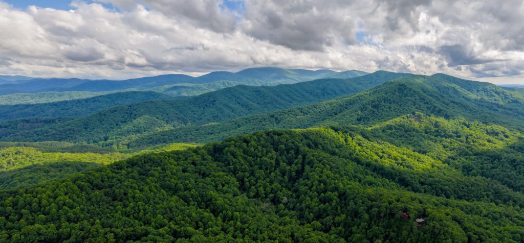
The Appalachian Mountains are among the oldest mountain ranges in the world.
Importance for indigenous communities
– Fertile valleys provided suitable land and resources.
– Abundant game provided food.
– Natural travel routes helped communities move through the region.
– The mountains have spiritual significance for indigenous peoples.
Economic importance
The Appalachian region has supported economic development through:
– Coal
– Timber
– Natural gas industries
– Tourism
– Renewable energy
The Appalachian Mountains show that mountains can be important for both traditional ways of life and modern economic development.
D. The Great Lakes
The Great Lakes are a chain of five massive freshwater lakes in North America.
Importance
– They have supported commerce and industry for centuries.
– Their shipping routes are important for transportation.
– Several cities depend on the lakes for drinking water.
– They provide habitats for diverse wildlife.
Environmental challenges
The lakes face problems such as:
1. Chemical contamination of lake sediments.
2. Water contamination caused by agricultural runoff.
3. Pollution from industrial processes.
The Great Lakes illustrate how freshwater bodies support people and economic activities but can also be harmed by human actions.
12. Australia
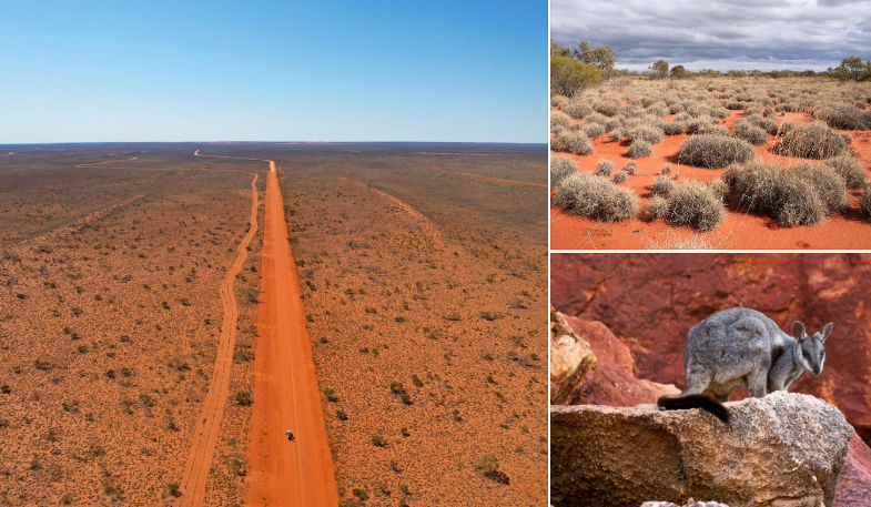
Australia contains extensive arid regions and deserts. A large part of the continent is desert or dry land, collectively described in the chapter as the Great Australian Desert.
A. The Great Australian Desert
The Great Australian Desert consists of several desert areas, including the Great Victoria Desert.
Climate and physical features
– Much of the region is dry and receives limited rainfall.
– The landscape includes extensive arid areas.
– Its geographical conditions influence the plants, animals, and communities that live there.
Wildlife
The Australian deserts support several types of animals.
Examples include:
– Reptiles
– Skinks
– Wallabies
– Bilbies
– Feral camels
Predators include dingoes, large lizards, cats, foxes, and snakes.
Some rare animals, including the sandhill dunnart, marsupial mole, and mallee fowl, are struggling to survive.
B. Indigenous communities: The Spinifex people
The Spinifex are an indigenous population of Australia that has lived in the desert for more than 25,000 years.
– Their way of life is closely connected with the desert environment.
– Their culture and traditions are being preserved by younger generations.
– Their culture and the unique geography and wildlife of the region attract tourists.
The Spinifex people demonstrate the long-standing relationship between indigenous communities, their land, and their cultural traditions.
C. Antarctica: The largest desert on Earth
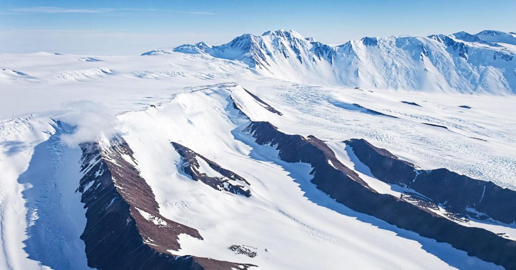
The chapter emphasises that deserts are not always hot. Cold deserts also exist.
– Antarctica is the largest desert on Earth.
– It covers more than 14 million square kilometres.
– Its area is more than four times the area of India.
– It is the coldest desert on Earth.
– It is even colder than the Arctic, which is the planet’s other polar desert.
This example shows that the defining feature of a desert is its extreme dryness, not necessarily high temperature.
13. How Geographical Features Influence Human Life
The chapter explains that geographical features are interconnected with human activities, natural ecosystems, and the global environment.
| Geographical Feature | Influence on Nature and Human Life |
|---|---|
| Oceans | Support marine life, regulate climate, contribute to rainfall, and facilitate international trade. |
| Ocean Currents | Influence the climate of coastal areas. |
| Coral Reefs | Provide food and shelter for marine species. |
| Mountains | Influence climate, provide freshwater, support biodiversity, and contain mineral resources. |
| Plateaus | Contain valuable resources and influence climate and river systems in some regions. |
| Plains | Support agriculture, settlement, transportation, and trade. |
| Deserts | Support specially adapted plants, animals, and human communities. |
| Grasslands | Provide habitats and grazing areas and can store carbon. |
| Rivers | Supply drinking water, irrigation, fishing, transport, and hydroelectric power. |
| Rainforests | Support biodiversity and indigenous communities. |
| Freshwater Lakes | Supply drinking water, support wildlife, and facilitate shipping and industry. |
Examples of connections between geography and human life
The European Plain: Fertile soils and relatively flat land support agriculture, transportation, and the growth of cities.
The Nile River: Water from the river supports agriculture and human settlement in dry regions.
The Alps: Melting snow and mountain water supplies support rivers, irrigation, drinking water, and hydroelectric power.
The Tibetan Plateau: Its rivers provide freshwater to extensive regions of Asia.
The Great Lakes: Freshwater supports cities, wildlife, commerce, and industry.
The Sahara Desert: Nomadic communities have developed ways of life suited to limited water and extreme heat.
These examples show that physical geography affects how people live, work, travel, and use natural resources.
14. Environmental Problems Caused by Human Activities
Human actions can disturb the balance of natural ecosystems. The chapter highlights pollution, overfishing, deforestation, climate change, and the excessive use of resources.
A. Deforestation
Deforestation involves the loss or removal of forest cover.
The chapter identifies deforestation as a threat to the Amazon Rainforest and as an activity that can disturb savannah ecosystems.
Its important implications include the loss of natural habitats and biodiversity.
B. Coral bleaching
Coral bleaching and coral death can occur because of changes in the chemical composition of ocean waters, largely caused by human actions.
Consequences include:
– Damage to coral reef ecosystems.
– Loss of habitats for marine animals.
– Threats to the biodiversity supported by reefs.
C. Pollution
Pollution can damage marine and freshwater environments.
Examples discussed in the chapter include:
– Pollution threatening the Great Barrier Reef.
– Chemical contamination of sediments in the Great Lakes.
– Water contamination caused by agricultural runoff and industrial processes.
D. Climate change
Climate change affects natural environments in several ways.
Examples from the chapter include:
– Snowmelt on the Tibetan Plateau, causing existing lakes to expand and new lakes to form.
– Melting permafrost in cold regions, releasing stored greenhouse gases.
– Threats to the Amazon Rainforest.
– Changes that threaten savannah ecosystems and coral reefs.
E. Overuse of natural resources
The chapter discusses overfishing and the use of natural resources as issues affecting ecosystems.
Excessive use of resources can disturb the balance between human activities and the natural environment.
F. Waste from fast fashion
The Atacama Desert has become a dumping ground for discarded clothing associated with fast fashion.
This problem demonstrates how the rapid production, consumption, and disposal of goods can create environmental and social challenges.
G. Desertification and biodiversity loss
The chapter’s concluding section identifies desertification and biodiversity loss among the environmental issues that can arise when human actions disturb natural systems.
Overall lesson: Human activities and natural ecosystems are interconnected. Protecting the environment requires responsible resource use and the conservation of natural habitats.

Leave a Reply